City of Ellsworth Ordinance 3071 to Amend Zoning Map

(First Published in the Ellsworth County Independent/
Reporter June 30, 2016)
ORDINANCE NO. 3071
AN ORDINANCE AMENDING THE ZONING MAP
IN THE CITY OF ELLSWORTH,
ELLSWORTH COUNTY, KANSAS
BE IT ORDAINED BY THE GOVERNING BODY OF THE CITY OF ELLSWORTH, KANSAS:
WHEREAS, the following described land is currently within city limits of the City of Ellsworth, Kansas, and
WHEREAS, the Planning Commission of the City of Ellsworth, Kansas, finds it advisable to update the zoning area described;
NOW THEREFORE, BE IT ORDAINED BY THE GOVERNING BODY OF THE CITY OF ELLSWORTH, KANSAS:
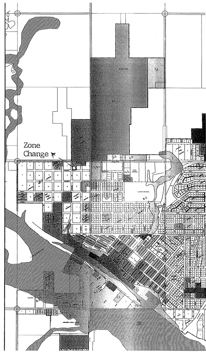
That the Zoning Map for the City of Ellsworth is amended so as to include the following described tracts of land. Said Zoning Amendment shall be reflected on the map entitled “Zoning Map of the City of Ellsworth.”
Zoning Change from – Residential – 1 (R-1) to Industrial -1 (I-1):
Minnick’s 2nd Addition, Beginning SW Corner of Block 2, Thence North 120’, East 138.5’, South 120’, then West 138.5’ to the Point of Beginning (POB), City of Ellsworth, KS
This ordinance shall take effect and be in force from and after its publication in the official city paper.
PASSED by the Governing Body of the City of Ellsworth. 27th day of June, 2016.
John J. Whitmer
Mayor
Attest:
Patti L. Booher, CMC
City Clerk
"Official Copy of Zoning District Map incorporated into Zoning Regulations by adoption of an ordinance by the governing body of the city on the 11th day of October, 2010"
1t 6/30


